


DC Metro & Bus: WMATA Realtime
2.82.31K Reviews
App Specs
- Version
- 4.0.62
- Updated On
- License
- Free
- Downloads
- 500,000+
- Developer
- Dixon Mobility, LLC
- Categories
- Maps & Navigation
- Platform
- Android
Screenshots

 Analysis by AppCompare
I use DC Metro & Bus: WMATA Realtime when I need a practical view of Washington, D.C.’s transit network rather than a broad map app trying to cover every transportation option at once. It is a free navigation app from Dixon Mobility, LLC, built around Metro train arrivals, bus tracking, trip planning, and an interactive map. That focused approach is its main appeal: when I already know I want to travel by Metrorail or Metrobus, I can get to the relevant information quickly.
My overall impression is mixed but useful. The app has a clear purpose and can be genuinely helpful during a commute, especially when I want to check whether a train is close or compare a planned route with the map. At the same time, the average rating of 2.8 from roughly 7,000 ratings suggests that the experience has not been consistently smooth for everyone. I would not treat it as my only travel tool, but I would consider keeping it installed if I regularly use Washington-area transit.
How the app feels in everyday use today
The first thing I notice is that this is not trying to be a general-purpose navigation platform. Its short store label, “DC Metro & Bus,” accurately reflects the narrow focus. Instead of starting with driving directions, walking routes, or a worldwide map, the app puts the local transit system at the center. That makes it more relevant than a large map service when my question is simply, “When is the next train?” or “Which bus should I take from here?”
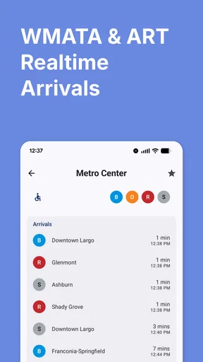
The real-time arrival function is the feature I would open most often. In a normal weekday scenario, I might leave work, walk toward a station, and check the train screen before deciding whether to hurry or take a slower connection. The value is not just seeing a route; it is reducing uncertainty between leaving a building and reaching the platform. A few minutes can change whether I wait, walk to another stop, or adjust my connection.
The bus tracker is especially useful for the last part of a trip, where scheduled times can be harder to judge from the street. I would use it before walking to a stop, not only after arriving there. That small change in routine can prevent an unnecessary wait, particularly when the stop is exposed to weather or located several blocks away. I still treat any live arrival estimate as guidance rather than a promise, because transit conditions can change after the app updates.
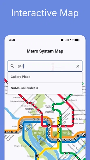
The interactive map gives the app a second role beyond arrival checking. I can use it to understand how stations and bus stops relate to one another, which is helpful when I am unfamiliar with a neighborhood. A map is also valuable when a direct route is not obvious. Instead of selecting the first suggested trip, I can look at the network and decide whether a transfer seems reasonable or whether walking to a different station would make more sense.
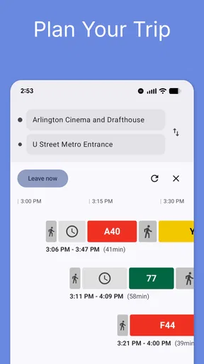
The trip planner is the feature I would use before leaving home. It is more useful when I enter the journey as a complete problem rather than checking one train at a time. I can think through the starting point, the destination, the likely transfer, and the final walk. That workflow helps expose the inconvenient parts of a trip early, such as a long connection or a stop that is farther from the destination than expected.
Worth Reading Before You Choose

EA SPORTS FC Mobile 26 Is a Bigger Football Game, but It Takes Time

Flipboard Shows What News Apps Must Do Beyond the Feed

Switching to Android Auto Means Rethinking Your Driving Routine

Google Calendar Makes a Crowded Week Easier to Manage

Ludo King Makes the Most of the Minutes Between Plans

Baby Panda World Brings Quick Play to Modern Phones, but Its Game Library Feels Busy
The strongest reason to use this app is its local focus, not a promise of perfect transit predictions. If I live in the area, visit often, or depend on Metro and bus service, that focus can make it faster to reach the information I need. If I only want occasional directions in a city I do not know, a larger navigation app may offer a more familiar and broader experience.
Where the focused design helps
A dedicated transit app can be less distracting than a general map application. When I open this one, I am already thinking about trains, buses, stops, and routes. That is useful during a busy commute, when I do not want to sort through driving estimates, restaurant listings, or unrelated map layers before finding transit information.
The app also makes sense for people who understand the broad layout of Washington’s network but need current details. A regular rider may know which line or bus corridor to use and only need the next arrival. In that situation, the app can function as a quick daily instrument rather than a full travel guide.
Visitors can benefit too, but I would recommend using the interactive map before the trip, not waiting until standing on a crowded platform. Looking at the route in advance makes it easier to recognize the correct station area and understand whether a bus connection is part of the journey. This is one of the less obvious ways to get more value from the app: use it for orientation first, then use real-time arrivals when it is time to move.
What the current version tells me about its direction
The current version is 4.0.62, and the app has been available since October 20, 2012. That long presence matters because it shows this is an established product rather than a newly launched experiment. I would expect an app with that history to have been shaped by years of changing transit habits, device updates, and user expectations, even though the version number alone does not tell me which individual features changed in each release.
I see the present release as a continuation of the app’s core identity: real-time Metro information, bus tracking, route planning, and a map in one local package. I would not read the version number as evidence that every part of the experience has been modernized. The more useful question is whether the current build performs those central tasks reliably on my phone and in the places where I travel.
The minimum operating system is Android 8.0. That requirement is relatively accommodating for people using older Android phones, although anyone with a very old device should still consider how smoothly maps and live updates perform in daily use. Compatibility is only the first test. A transit app can install successfully and still feel inconvenient if screens load slowly or if checking arrival information takes too many taps.
The app remains free to download, with optional in-app purchases ranging from $1.99 to $23.99 per item. I would start with the free experience and judge whether it covers my normal commute before spending anything. That is particularly important here because the central question is not whether the app has a long feature list; it is whether its arrival information and planning tools are dependable enough for my routine.
How existing users may experience the evolution
For someone who has used the app for years, the most important benefit of a newer version is likely continuity. Keeping a familiar transit tool available can be less stressful than changing workflows every time a different navigation service changes its layout. Existing users already know where they look for trains, buses, or the map, so even modest improvements can matter if they reduce friction during a rushed trip.
There is also a trade-off. Familiarity can preserve useful habits, but it can make older design decisions more noticeable beside newer navigation apps. A person accustomed to polished, highly automated route planning may find this app more functional than elegant. I would approach it as a specialized utility: open it for a specific transit question, make a decision, and continue traveling.
My advice to existing users is to build a backup habit rather than abandoning the app immediately. Before a time-sensitive journey, check the route and arrival information, then keep a broader map service available for walking directions or an alternative route. This is not an admission that the app is useless; it is a sensible response to the difference between live transit estimates and the real-world conditions that can affect a trip.
Another useful habit is checking the entire journey before boarding the first vehicle. A rider may focus on the next train and forget the transfer or final bus. The trip planner and map are most valuable when used together: planning identifies the sequence, while the map helps me judge the physical movement between stations, stops, and the destination.
Where it still falls short
The rating of 2.8 is the clearest warning sign for me. It does not prove that the app will fail on my phone, but it does mean I would test it before depending on it for an airport connection, an appointment, or the last train home. A transit tool has a higher standard than a casual app because inaccurate or delayed information can affect an entire day.
The narrow scope can also be a limitation. If I need detailed walking navigation, cycling directions, driving alternatives, or a broader mix of transportation services, I would prefer a general map application. This app is strongest when the trip is centered on DC Metro or Metrobus. It is less convincing as a universal travel companion.
Live arrival information can create false confidence if I read it too literally. A displayed estimate may change while I am walking to the station or stop. I would use it to make a practical decision, such as whether to leave now or wait a few minutes, but I would leave extra time for transfers and platform movement. The app can improve awareness without eliminating the unpredictability of public transportation.
The optional purchase model is another point I would examine carefully. Because items can cost from $1.99 up to $23.99, I would avoid assuming that every useful convenience is included at no cost. I would first identify the features I actually need and decide whether they justify a purchase. For a rider who only checks occasional arrivals, paying for extras may not make sense; for a frequent commuter, the calculation could be different.
The age rating is Everyone, which makes the app broadly suitable from a content perspective. That does not automatically make it ideal for every traveler. A child, older passenger, or visitor unfamiliar with the system may still need a simpler explanation of the route, station entrances, transfers, and walking segments. I would not hand the app over as the only source of guidance without first checking the journey together.
Who should install it and who should skip it
I would recommend trying it if I lived in the Washington area and used Metro or Metrobus several times a week. The combination of arrival checks, bus tracking, trip planning, and an interactive map covers the decisions I make most often. It is also a reasonable choice for visitors who want a transit-specific companion and are willing to verify an unfamiliar route before setting out.
It is a better fit for independent riders than for people who want a highly guided, all-purpose navigation experience. If I already know how to interpret a station, transfer, and bus stop, the focused tools are enough. If I need constant turn-by-turn walking instructions or a single app that compares every transportation mode, I would use a broader alternative instead.
I would skip making it my sole travel solution if my schedule has no flexibility. That includes a flight, an interview, a medical appointment, or a late-night connection where a missed vehicle creates a serious problem. In those cases, I would check the app for local transit information but confirm the overall journey with another source and allow contingency time.
The install base of over 500,000 also indicates that many people have chosen to try this local tool, but popularity does not replace personal testing. I would install it, search for a familiar route, compare the results with what I already know, and then see how it behaves during an actual commute. That short trial tells me more than a download count because transit conditions and phone performance vary by situation.
Practical ways I would use it
For a morning commute, I would check the planned route before leaving, then use the arrival view again near the station. The first check helps me prepare for transfers; the second reflects current conditions. Separating those two checks is better than planning once and assuming the original timing will remain unchanged.
For a bus trip, I would look at the map and stop location before walking out. Some stops are easy to miss when I am in an unfamiliar block, and a few minutes spent understanding the surrounding streets can be more valuable than staring at an arrival estimate. Once I know where I am going, the tracker becomes a decision tool rather than a substitute for basic orientation.
For a visitor, I would save the route mentally by identifying the starting station, transfer point, and final stop. I would not rely on recognizing every street from the map while moving. Instead, I would use the app to reduce the number of decisions I need to make on the journey. That approach is especially helpful when network coverage, crowds, or distractions make constant checking inconvenient.
For a disrupted journey, I would compare the trip planner’s suggestion with the interactive map instead of accepting the first option automatically. A route that looks efficient in transit time may involve an awkward walk or a transfer I would rather avoid. The map gives me context, while the planner gives me structure. Neither should be treated as a replacement for judgment.
What I would watch before relying on it
I would pay attention to whether the current release makes the basic tasks faster and clearer: opening arrival information, finding a bus stop, reading a route, and returning to a familiar view. Those are more meaningful improvements for this app than decorative changes. A transit utility earns its place on my phone by reducing the time between a question and a useful answer.
I would also watch how well the app handles the boundary between planning and live travel. The best experience would help me move from a planned route to current arrival information without making me start over. If those parts feel disconnected, I would continue using the app selectively rather than depending on it for the entire journey.
My final view is that DC Metro & Bus: WMATA Realtime is worth trying for riders who want a dedicated Washington transit tool, but I would keep expectations practical. It offers the right set of functions for checking trains, following buses, planning trips, and reading the network map, and its free entry point makes testing easy. Its modest average rating and possible purchase costs mean I would verify its usefulness on my own routes before paying for anything or making it my only navigation option.
After using it, I would describe it to a friend as a useful specialist rather than a flawless replacement for every map app. If your daily travel revolves around DC Metro and Metrobus, install it and test it against a familiar journey. If you need broad multimodal navigation, precise walking guidance, or maximum confidence for an important appointment, pair it with a more general alternative. That balanced setup gives the app room to be helpful without asking it to do a job it was not designed to handle.
Pros
- Provides live arrival predictions for Metro trains and buses.
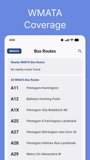
- Covers the entire WMATA service area in one app.
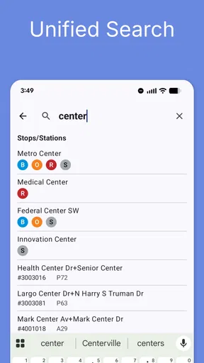
- Station and stop search makes route planning quick.
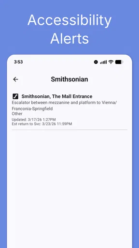
- Useful service alerts help users avoid disruptions.
- Simple interface is easy to use during daily commutes.
Cons
- Prediction accuracy can drop during delays or service changes.
- Some features depend on a reliable mobile data connection.
- The interface may feel dated compared with newer transit apps.
- Bus stop information can be less clear in crowded areas.
- Frequent commuters may notice occasional data refresh delays.
FAQs for DC Metro & Bus: WMATA Realtime
What is DC Metro & Bus: WMATA Realtime?
DC Metro & Bus: WMATA Realtime is a travel and transit app designed for people using Washington, D.C.’s Metrorail and Metrobus services. It provides access to route information, station details, schedules, service updates, and estimated arrival times where available. The app is especially useful when planning a trip, checking a vehicle’s expected arrival, or reviewing transit options before leaving home.
Does the app provide real-time Metro and bus arrival information?
Yes, the app is intended to show real-time or near-real-time arrival information for selected Metro stations and bus stops, depending on the data supplied by WMATA. After choosing a route, station, or stop, you can generally view upcoming departures and estimated arrival times. Keep in mind that predictions may change because of traffic, congestion, equipment problems, weather, or delays in the transit agency’s data feed.
Can I use DC Metro & Bus: WMATA Realtime to plan a complete trip?
The app can help with many parts of a Washington, D.C. transit journey, including checking routes, locating nearby stations or stops, viewing schedules, and comparing upcoming departures. However, its exact trip-planning capabilities may depend on the current version and the information available from WMATA. For complicated journeys involving walking directions, transfers, or service disruptions, it is wise to verify the route with official WMATA information as well.
Does the app require an internet connection or location access?
An internet or mobile-data connection is normally needed to retrieve updated arrival predictions, service notices, and other live transit information. Some basic schedules or previously loaded information may remain visible temporarily, but offline data should not be treated as current. Location permission can also make the app more convenient by helping identify nearby stations and bus stops, although you may be able to search manually without granting location access.
Is DC Metro & Bus: WMATA Realtime free to download and use?
The application is generally available as a free download, although the store listing should be checked for the latest pricing, advertising, or optional in-app purchase details. Availability of particular features can vary between Android and iOS versions. Before downloading, review the permissions and privacy information, especially if you are concerned about location data, network usage, advertisements, or how information connected with transit searches is handled.


